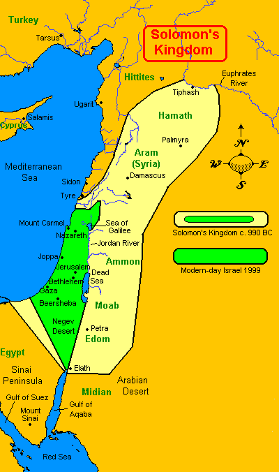
Map of King Solomon's Israel The best known historic maps dating from 1000 B.C.E. depict the stable and peaceful borders of King Solomon's Israel which were recorded in the great libraries of Babylon, Persia, Egypt and Jerusalem. The northern Aramaen Kingdoms of Aram were connected to Jerusalem by roads such as the Damascus Road which can be seen today. The word Syria is written on the map as a modern reference. It's starting point is the Damascus Gate in Jerusalem. It is notable that the land of the Aramaens was interspursed with Canaanite settlements. The true Aramaens are related Mesopotamians as the wives of Isaac and Jacob were Aramaen. Their language, Aramaic, was not only the common written language of records and contracts throughout Mesopotamia but it was also the original language of Jews and Jewish texts. |
 ... ...

